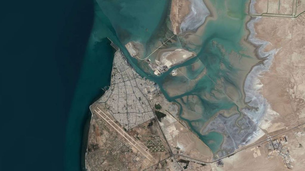
The port of Bushehr is located in 28,58 N and 50, 50 E in the north end of a peninsula on the coast of the Persian Gulf. This peninsula is 14 Km long. The depth of water is near to 7m in the external anchorage leading to internal anchorage by the external channel 9200m in length and from the internal anchorage to KHOR SOLTANI, Bushehr berth and then to KHOR BOODER by the internal channel 3900m in length. The channel is 140m in average width.
Climate in Bushehr Port
Bushehr port has got a semi-tropical climate with very hot and humid Summer and temperate Winter. The seasonal South Western winds blow on Bushehr sea from the beginning of June to the end of October but they rarely reach the harbor. The seasonal North Eastern winds blow on Bushehr sea and sometimes very strongly on the land from the end of December to the beginning of May.
The power of North Wind usually reaches to 6 in Beaufort scale, but it may rarely border on 8.
The average power of Wind in Winter is 4 in Beaufort scale
The temperature range during summer is +35 to +40 degrees centigrade, whereas it mat border on +2 degrees centigrade in Winter.
The humidity range during Winter is %40 to %80 and %30 to %99 in Summer.
TIDAL RANGE
The ebb and tide in Bushehr port is diurnal. The tidal range differs from 1 m to 1.6 m.
The highest tide may reach to 2 m and the lowest ebb may border on .7 m. The speed of water current in the internal channel and KHORE SOLTANI may reach to 2-3 knots in ebb and flow conditions
The maximum height of the wave in the external anchorage is almost 1.5 m and .6 in the internal anchorage.